| News
City of Pointe-Claire georeferenced survey
The City of Pointe-Claire would like to inform you that a 3D georeferenced survey of the city is currently underway and will continue until June 15. This capturing and digitization of the 200 km road network will provide information to plan infrastructure projects and build a platform to consult information on the city.
This project is being carried out using a specialized vehicle equipped with a very high-precision camera on its roof that surveys a distinctive marking located at various checkpoints throughout the city.
The marking that can be found throughout the city
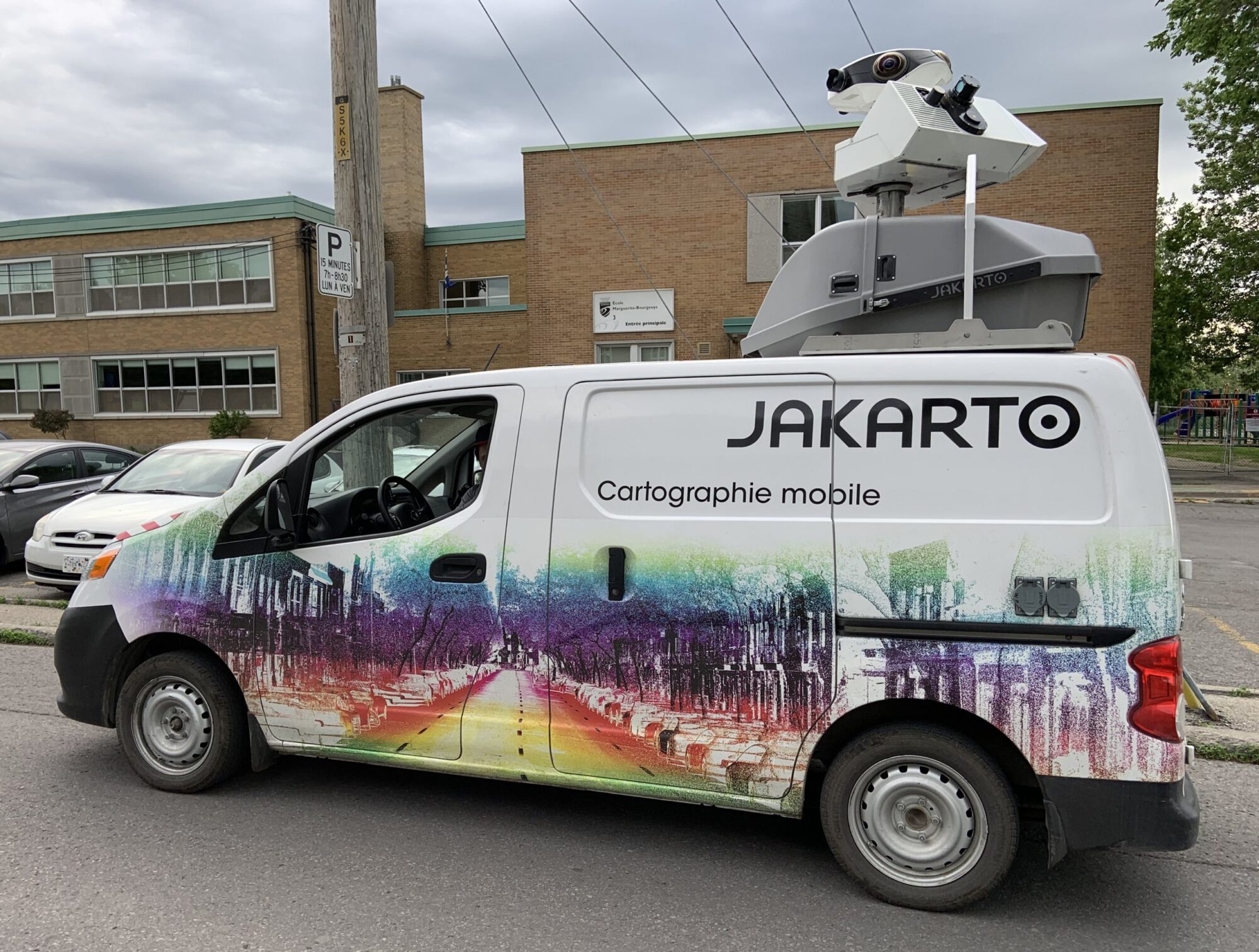
The specialized vehicle